Fiskerton signal box
Introduction
The photograph on this page of Fiskerton signal box by Chris Morgan as part of the Geograph project.
The Geograph project started in 2005 with the aim of publishing, organising and preserving representative images for every square kilometre of Great Britain, Ireland and the Isle of Man.

There are currently over 7.5m images from over 14,400 individuals and you can help contribute to the project by visiting https://www.geograph.org.uk
Fiskerton signal box
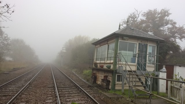
Image: © Chris Morgan Taken: 2 Nov 2015
This box's prime purpose is to control the road crossing, and that should be automated within the next 18 months. Some subsidence is evident at the back!
Images are licensed for reuse under creativecommons.org/licenses/by-sa/2.0
Image Location
Latitude
53.060626
Longitude
-0.911582