WW2 building
Introduction
The photograph on this page of WW2 building by Evelyn Simak as part of the Geograph project.
The Geograph project started in 2005 with the aim of publishing, organising and preserving representative images for every square kilometre of Great Britain, Ireland and the Isle of Man.

There are currently over 7.5m images from over 14,400 individuals and you can help contribute to the project by visiting https://www.geograph.org.uk
WW2 building
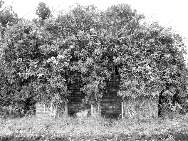
Image: © Evelyn Simak Taken: 8 Nov 2015
This is the guard hut, guarding the nearby buried reserve > http://www.geograph.org.uk/photo/4732612 an underground operating centre for the transmitter site of RAF Stoke Holy Cross > http://www.geograph.org.uk/article/RAF-Stoke-Holy-Cross-Chain-Home-radar-station/1 which was a Chain Home radar station during the war. One of the tiny rooms contained a chemical toilet.
Images are licensed for reuse under creativecommons.org/licenses/by-sa/2.0
Image Location
Latitude
52.57354
Longitude
1.3264