Demolition of former Orpington police station
Introduction
The photograph on this page of Demolition of former Orpington police station by Ian Capper as part of the Geograph project.
The Geograph project started in 2005 with the aim of publishing, organising and preserving representative images for every square kilometre of Great Britain, Ireland and the Isle of Man.

There are currently over 7.5m images from over 14,400 individuals and you can help contribute to the project by visiting https://www.geograph.org.uk
Demolition of former Orpington police station
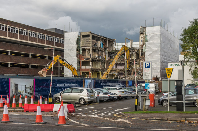
Image: © Ian Capper Taken: 4 Nov 2015
The former Orpington police station being demolished, in readiness for a housing development to be named Brunswick Square. In the left background is the Sainsbury's multi-storey car park.
Images are licensed for reuse under creativecommons.org/licenses/by-sa/2.0
Image Location


Leaflet Map data © OpenStreetMap
Latitude
51.375749
Longitude
0.101201