Camden Terrace, Brighton
Introduction
The photograph on this page of Camden Terrace, Brighton by Simon Carey as part of the Geograph project.
The Geograph project started in 2005 with the aim of publishing, organising and preserving representative images for every square kilometre of Great Britain, Ireland and the Isle of Man.

There are currently over 7.5m images from over 14,400 individuals and you can help contribute to the project by visiting https://www.geograph.org.uk
Camden Terrace, Brighton
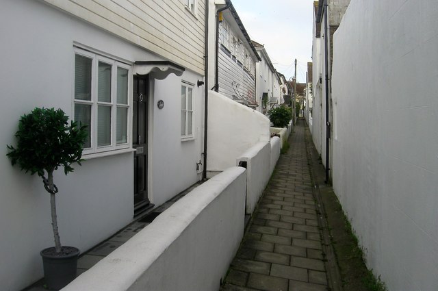
Image: © Simon Carey Taken: 1 Nov 2015
A twitten that runs from Upper Gloucester Road to Guildford Road that was developed in the 1840s. There are eleven properties on the western side and just six on the eastern side.
Images are licensed for reuse under creativecommons.org/licenses/by-sa/2.0
Image Location
Latitude
50.827945
Longitude
-0.1426