New path and temporary dam, Philiphaugh mill lade
Introduction
The photograph on this page of New path and temporary dam, Philiphaugh mill lade by Jim Barton as part of the Geograph project.
The Geograph project started in 2005 with the aim of publishing, organising and preserving representative images for every square kilometre of Great Britain, Ireland and the Isle of Man.

There are currently over 7.5m images from over 14,400 individuals and you can help contribute to the project by visiting https://www.geograph.org.uk
New path and temporary dam, Philiphaugh mill lade
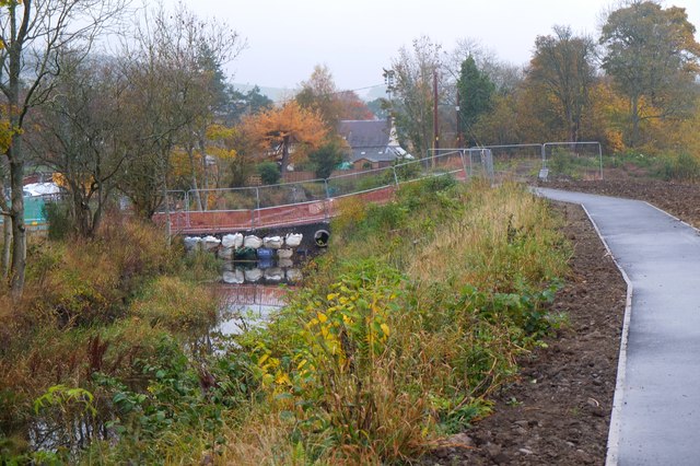
Image: © Jim Barton Taken: 28 Oct 2015
A new tarmac path has been made along the embankment built as part of the Flood Protection Scheme. The lade has been dammed here to permit construction of new flood defence walls downstream, before the lade joins the Ettrick Water.
Images are licensed for reuse under creativecommons.org/licenses/by-sa/2.0
Image Location
Latitude
55.544672
Longitude
-2.859084