Viaduct Road, Brighton
Introduction
The photograph on this page of Viaduct Road, Brighton by Simon Carey as part of the Geograph project.
The Geograph project started in 2005 with the aim of publishing, organising and preserving representative images for every square kilometre of Great Britain, Ireland and the Isle of Man.

There are currently over 7.5m images from over 14,400 individuals and you can help contribute to the project by visiting https://www.geograph.org.uk
Viaduct Road, Brighton
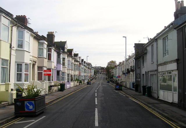
Image: © Simon Carey Taken: 25 Oct 2015
The road runs between Preston Circus and Ditchling Road and was developed in the mid 1840s and was originally known as Montpelier Road East running along the old parish boundary between Brighton to the south and Preston to the north. Later on it became the A27 until the bypass was opened in the early 1990s after which it was designated as the A270 with this stretch also shared by the A23 southbound traffic. The large black plant pots were added in early 2015 as a traffic calming measure to much local derision.
Images are licensed for reuse under creativecommons.org/licenses/by-sa/2.0
Image Location
Latitude
50.832964
Longitude
-0.135869