Maritime Line, Penryn
Introduction
The photograph on this page of Maritime Line, Penryn by Jaggery as part of the Geograph project.
The Geograph project started in 2005 with the aim of publishing, organising and preserving representative images for every square kilometre of Great Britain, Ireland and the Isle of Man.

There are currently over 7.5m images from over 14,400 individuals and you can help contribute to the project by visiting https://www.geograph.org.uk
Maritime Line, Penryn
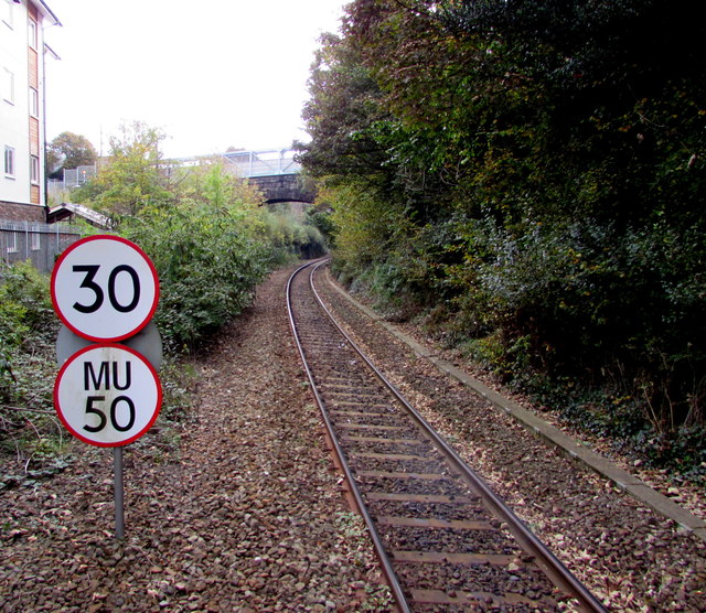
Image: © Jaggery Taken: 16 Oct 2015
Looking south along the Maritime Line from Penryn station towards Helston Road bridge. The Maritime Line is a branch line from Truro to Falmouth Docks. The next station ahead is Penmere. Signs show a 30mph speed limit, 50mph for multiple units.
Images are licensed for reuse under creativecommons.org/licenses/by-sa/2.0
Image Location
Latitude
50.1693
Longitude
-5.110535