20 Carolgate
Introduction
The photograph on this page of 20 Carolgate by Alan Murray-Rust as part of the Geograph project.
The Geograph project started in 2005 with the aim of publishing, organising and preserving representative images for every square kilometre of Great Britain, Ireland and the Isle of Man.

There are currently over 7.5m images from over 14,400 individuals and you can help contribute to the project by visiting https://www.geograph.org.uk
20 Carolgate
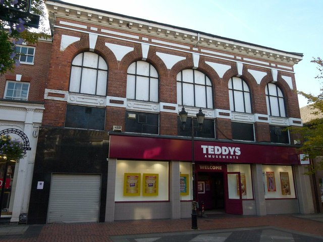
Image: © Alan Murray-Rust Taken: 11 Oct 2015
Built for a firm of retail ironmongers. The presence of iron panels below the upper windows indicates the likely presence of a steel frame, an early example of this in the area. The frontage originally had a full row of windows at first floor level separated from the ground floor windows by similar iron panels, but a new frontage of iron and glass was installed in the early 20th century, later replaced with the present uninspired version. It was converted to an amusement arcade in the 1970s.
Images are licensed for reuse under creativecommons.org/licenses/by-sa/2.0
Image Location
Latitude
53.321505
Longitude
-0.942488