Rodford from the railway
Introduction
The photograph on this page of Rodford from the railway by Derek Harper as part of the Geograph project.
The Geograph project started in 2005 with the aim of publishing, organising and preserving representative images for every square kilometre of Great Britain, Ireland and the Isle of Man.

There are currently over 7.5m images from over 14,400 individuals and you can help contribute to the project by visiting https://www.geograph.org.uk
Rodford from the railway
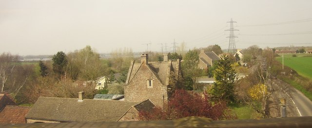
Image: © Derek Harper Taken: 10 Apr 2015
This forms a sort of sequence, with Image and Image, of shots taken from trains crossing the railway viaduct over Westerleigh Road. The gabled building in the centre here is the C17 Sign of The Dolphin http://www.historicengland.org.uk/listing/the-list/list-entry/1287900 . Visible between it and the Araucaria is Westerleigh Tabernacle (1844) http://www.historicengland.org.uk/listing/the-list/list-entry/1216076 , now the Immanuel Christian School.
Images are licensed for reuse under creativecommons.org/licenses/by-sa/2.0
Image Location


Leaflet Map data © OpenStreetMap
Latitude
51.521351
Longitude
-2.434645