West Coastway Railway
Introduction
The photograph on this page of West Coastway Railway by Simon Carey as part of the Geograph project.
The Geograph project started in 2005 with the aim of publishing, organising and preserving representative images for every square kilometre of Great Britain, Ireland and the Isle of Man.

There are currently over 7.5m images from over 14,400 individuals and you can help contribute to the project by visiting https://www.geograph.org.uk
West Coastway Railway
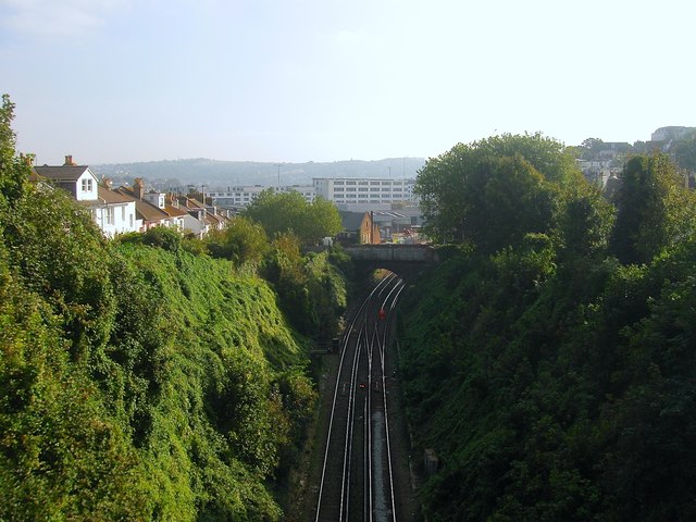
Image: © Simon Carey Taken: 11 Oct 2015
The line from Brighton to Shoreham opened in 1841 and involved the excavation of a large cliff. Viewed from Prestonville Road with New England Road bridge in view. The station is out of view beyond the curve.
Images are licensed for reuse under creativecommons.org/licenses/by-sa/2.0
Image Location
Latitude
50.832037
Longitude
-0.14542