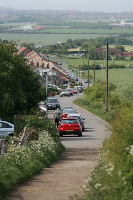
Pontac Road
Introduction
The photograph on this page of Pontac Road by Mick Garratt as part of the Geograph project.
The Geograph project started in 2005 with the aim of publishing, organising and preserving representative images for every square kilometre of Great Britain, Ireland and the Isle of Man.
There are currently over 7.5m images from over 14,400 individuals and you can help contribute to the project by visiting https://www.geograph.org.uk

Image: © Mick Garratt Taken: 3 Jun 2007
So named after the farm to the east (off right). A narrow gauge railway used to run along its length servicing the Upleatham Ironstone Mine (main entrance behind photographer). At the second kink in the lane the railway actually continued in a straight line and parallel to the lane. The housing seen to the left of the lane was built on the course of this old railway in the 1960s.

