Ditchling Road, Fiveways, Brighton
Introduction
The photograph on this page of Ditchling Road, Fiveways, Brighton by Simon Carey as part of the Geograph project.
The Geograph project started in 2005 with the aim of publishing, organising and preserving representative images for every square kilometre of Great Britain, Ireland and the Isle of Man.

There are currently over 7.5m images from over 14,400 individuals and you can help contribute to the project by visiting https://www.geograph.org.uk
Ditchling Road, Fiveways, Brighton
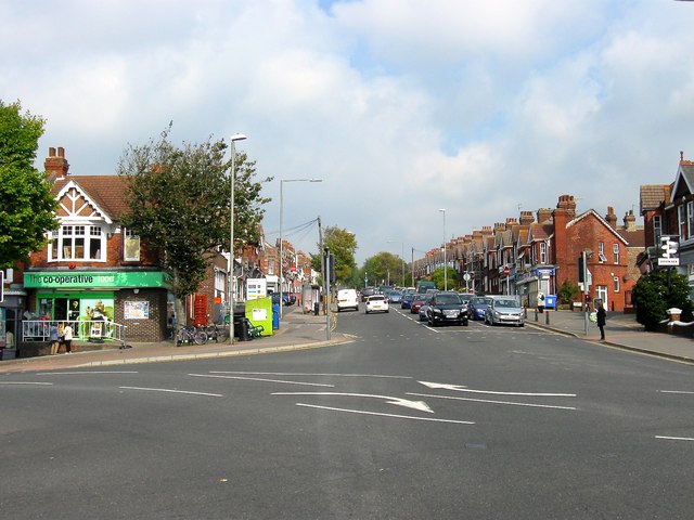
Image: © Simon Carey Taken: 4 Oct 2015
One of the old London-Brighton roads which went via Ditchling Beacon, Lindfield and Godstone and one of the longest named, beginning on The Level, TQ 30 06, then beyond the city boundaries to Ditchling Beacon, TQ 32 16. Fiveways is the name of the junction and is often used locally for the surrounding district located at a point where Preston ends and Hollingdean, which lies in a valley to the east, begins. The junction consists of Ditchling Road that runs from south to north, Preston Drove heading west to Preston village and the A23, Stanford Avenue heading south west also to the A23, and Hollingbury Road that heads east then south to Hollingdean Road. Prior to the 1880s the junction just consisted of a track to Preston.
Images are licensed for reuse under creativecommons.org/licenses/by-sa/2.0
Image Location
Latitude
50.844284
Longitude
-0.135133