London-Brighton Railway
Introduction
The photograph on this page of London-Brighton Railway by Simon Carey as part of the Geograph project.
The Geograph project started in 2005 with the aim of publishing, organising and preserving representative images for every square kilometre of Great Britain, Ireland and the Isle of Man.

There are currently over 7.5m images from over 14,400 individuals and you can help contribute to the project by visiting https://www.geograph.org.uk
London-Brighton Railway
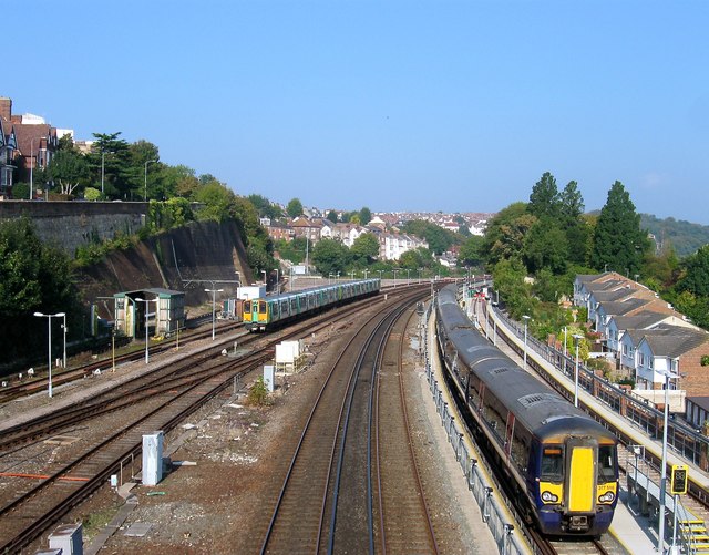
Image: © Simon Carey Taken: 4 Oct 2015
Viewed from Image with the mainline in the centre and the northern extent of the Lowers Walk sidings either side. The latter were added in the 1880s. The open space on the left beyond the parked train was once the site of former carriage sheds which were removed about seven years ago.
Images are licensed for reuse under creativecommons.org/licenses/by-sa/2.0
Image Location
Latitude
50.838409
Longitude
-0.150281