The Mere, Walton on the Naze
Introduction
The photograph on this page of The Mere, Walton on the Naze by Peter Pearson as part of the Geograph project.
The Geograph project started in 2005 with the aim of publishing, organising and preserving representative images for every square kilometre of Great Britain, Ireland and the Isle of Man.

There are currently over 7.5m images from over 14,400 individuals and you can help contribute to the project by visiting https://www.geograph.org.uk
The Mere, Walton on the Naze
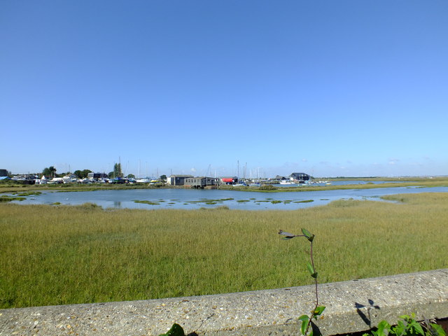
Image: © Peter Pearson Taken: 30 Sep 2015
The Mere as it is now known was originally the 24 acre mill pond for the tide mill which stood on the red brick structure which now supports the grey shed in the middle of the scene. The two water wheels that drove the mill were housed in that structure beside which is what remains of sluice used to allow water on a rising tide to fill the pond and prevent its out-flow on the falling tide. From the time the mill ceased operations until the mid 1960/70's the mill pond was used as a boating lake where visitors to the town could try their hand at rowing, sailing or younger people spend hours in dinghies fitted with paddle wheels. Alas now all a distant memory, the area is planned for major development for a marina and housing.
Images are licensed for reuse under creativecommons.org/licenses/by-sa/2.0
Image Location
Latitude
51.853156
Longitude
1.267014