The village street, Bury
Introduction
The photograph on this page of The village street, Bury by Stefan Czapski as part of the Geograph project.
The Geograph project started in 2005 with the aim of publishing, organising and preserving representative images for every square kilometre of Great Britain, Ireland and the Isle of Man.

There are currently over 7.5m images from over 14,400 individuals and you can help contribute to the project by visiting https://www.geograph.org.uk
The village street, Bury
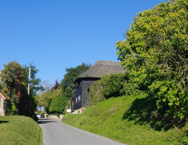
Image: © Stefan Czapski Taken: 30 Sep 2015
Looking north. Bury is one of those Sussex villages where farmyards are situated along the settlement's main street. In Bury's case, the sites close to the village centre are no longer active farms, and many old farm buildings are in residential use. At Houghton, nearby, the traditional pattern survives, with working farmyards close to the main village street.
Images are licensed for reuse under creativecommons.org/licenses/by-sa/2.0
Image Location


Leaflet Map data © OpenStreetMap
Latitude
50.911389
Longitude
-0.562187