Gatepiers, Netherwitton
Introduction
The photograph on this page of Gatepiers, Netherwitton by Stephen Richards as part of the Geograph project.
The Geograph project started in 2005 with the aim of publishing, organising and preserving representative images for every square kilometre of Great Britain, Ireland and the Isle of Man.

There are currently over 7.5m images from over 14,400 individuals and you can help contribute to the project by visiting https://www.geograph.org.uk
Gatepiers, Netherwitton
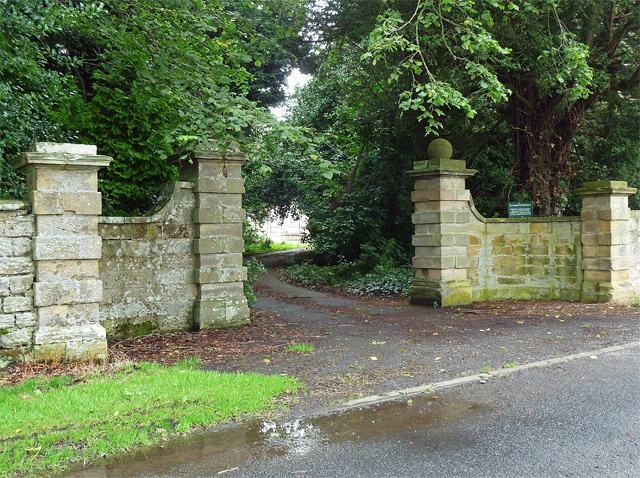
Image: © Stephen Richards Taken: 18 Aug 2012
Rusticated piers joined by quadrant links and topped by ball finials, late C17th or early C18th. They mark the entrance to Netherwitton Hall (Image]). Grade II listed.
Images are licensed for reuse under creativecommons.org/licenses/by-sa/2.0
Image Location


Leaflet Map data © OpenStreetMap
Latitude
55.207746
Longitude
-1.840164