Barling and Foulness Island from the air
Introduction
The photograph on this page of Barling and Foulness Island from the air by Thomas Nugent as part of the Geograph project.
The Geograph project started in 2005 with the aim of publishing, organising and preserving representative images for every square kilometre of Great Britain, Ireland and the Isle of Man.

There are currently over 7.5m images from over 14,400 individuals and you can help contribute to the project by visiting https://www.geograph.org.uk
Barling and Foulness Island from the air
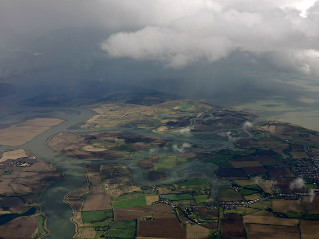
Image: © Thomas Nugent Taken: 14 Sep 2015
Barling is in the foreground, with the River Roach on the left, Potton Island in the centre and Foulness Island on the coast.
Images are licensed for reuse under creativecommons.org/licenses/by-sa/2.0
Image Location
Latitude
51.56953
Longitude
0.779728