Disturbed benchmark on #141 Ashdown Drive
Introduction
The photograph on this page of Disturbed benchmark on #141 Ashdown Drive by Roger Templeman as part of the Geograph project.
The Geograph project started in 2005 with the aim of publishing, organising and preserving representative images for every square kilometre of Great Britain, Ireland and the Isle of Man.

There are currently over 7.5m images from over 14,400 individuals and you can help contribute to the project by visiting https://www.geograph.org.uk
Disturbed benchmark on #141 Ashdown Drive
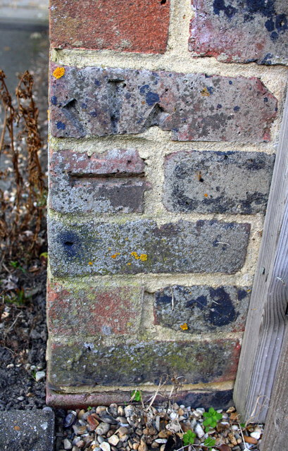
Image: © Roger Templeman Taken: 19 Sep 2015
Ordnance Survey cut mark benchmark described on the Bench Mark Database at http://www.bench-marks.org.uk/bm70401 . The mark has evidently been subject to rearrangement of the bricks as it is now inverted and moved around the corner from where it was originally cut
Images are licensed for reuse under creativecommons.org/licenses/by-sa/2.0
Image Location
Latitude
51.100713
Longitude
-0.182824