
Dover House, Northleach
Introduction
The photograph on this page of Dover House, Northleach by Derek Harper as part of the Geograph project.
The Geograph project started in 2005 with the aim of publishing, organising and preserving representative images for every square kilometre of Great Britain, Ireland and the Isle of Man.

There are currently over 7.5m images from over 14,400 individuals and you can help contribute to the project by visiting https://www.geograph.org.uk
Dover House, Northleach
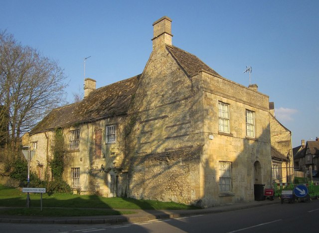
Image: © Derek Harper Taken: 8 Apr 2015
On the corner of the High Street (right) and Farmington Road, and built in about 1619 http://list.historicengland.org.uk/resultsingle.aspx?uid=1154890&searchtype=mapsearch . The "house formerly extended further left of present front, the additional bays were refronted in the early C19 in a similar way to the remaining 2 bays. This part of the house was dismantled and transported to America by Henry Ford in 1937". I wonder where it is? He shipped another Cotswold property to Greenfield Village, Dearborn http://www.cotswolds.info/places/greenfield.shtml . Does the Monarch's Way pass this junction? The 1:25000 map says not, the LDPA map says it does.
Images are licensed for reuse under creativecommons.org/licenses/by-sa/2.0
Image Location

Latitude
51.829181
Longitude
-1.835544