Knightswood from the air
Introduction
The photograph on this page of Knightswood from the air by Thomas Nugent as part of the Geograph project.
The Geograph project started in 2005 with the aim of publishing, organising and preserving representative images for every square kilometre of Great Britain, Ireland and the Isle of Man.

There are currently over 7.5m images from over 14,400 individuals and you can help contribute to the project by visiting https://www.geograph.org.uk
Knightswood from the air
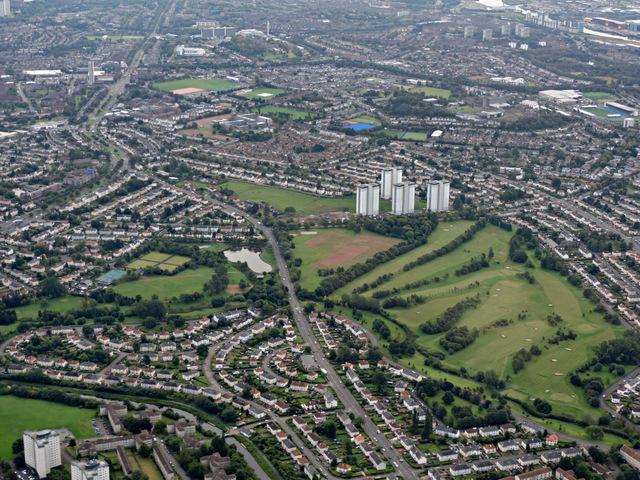
Image: © Thomas Nugent Taken: 14 Sep 2015
Knightswood golf course is prominent, Scotstoun Stadium is at the top right and the A82 Great Western Road is towards the top left. The towerblocks in the centre are on Lincoln Avenue.
Images are licensed for reuse under creativecommons.org/licenses/by-sa/2.0
Image Location
Latitude
55.897663
Longitude
-4.360684