The Humber Stone
Introduction
The photograph on this page of The Humber Stone by Mat Fascione as part of the Geograph project.
The Geograph project started in 2005 with the aim of publishing, organising and preserving representative images for every square kilometre of Great Britain, Ireland and the Isle of Man.

There are currently over 7.5m images from over 14,400 individuals and you can help contribute to the project by visiting https://www.geograph.org.uk
The Humber Stone
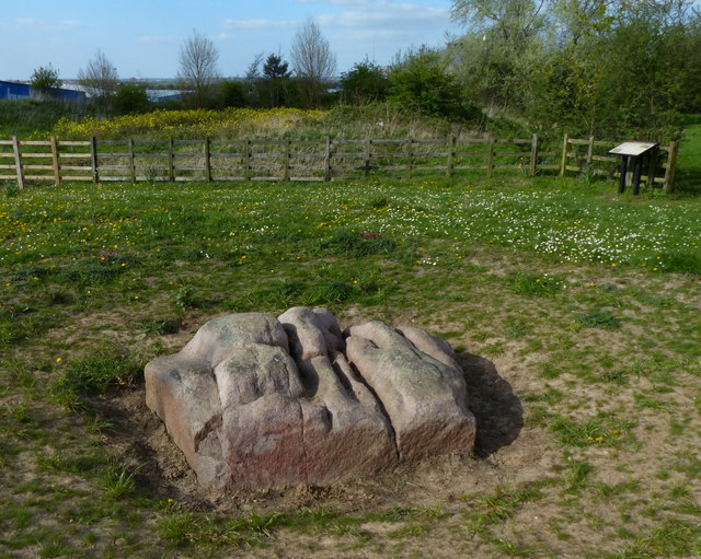
Image: © Mat Fascione Taken: 18 Apr 2014
The following is from the information board: Also known as the Ho Stone, Hoston Stone, Hell Stone and Holy Stone it is believed to have given its name to the nearby village of Humberstone. This standing stone (Menhir) of red granite is derived from a great glacial erratic, deposited here after being swept down from the Mountsorrel area during the ice age, some 400,000 years ago. Local folklore suggests that it was dropped by a God and is the home of the fairies. Until the mid 18th century it stood almost 10 feet tall in a hollow. Legend has it that the local farmer had the top broken off to make it easier to plough the field. From that point on he never prospered, eventually losing all his land and wealth, dying in the local workhouse six years later. It is located at the corner of Waterside Road and Sandhills Avenue.
Images are licensed for reuse under creativecommons.org/licenses/by-sa/2.0
Image Location
Latitude
52.657952
Longitude
-1.078915