Chimneys reconstruction, Brook House, Brook Street
Introduction
The photograph on this page of Chimneys reconstruction, Brook House, Brook Street by John Baker as part of the Geograph project.
The Geograph project started in 2005 with the aim of publishing, organising and preserving representative images for every square kilometre of Great Britain, Ireland and the Isle of Man.

There are currently over 7.5m images from over 14,400 individuals and you can help contribute to the project by visiting https://www.geograph.org.uk
Chimneys reconstruction, Brook House, Brook Street
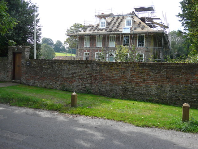
Image: © John Baker Taken: 23 Aug 2015
Planning permission has been granted by Dover District Council under application numbers DOV/15/0225 for the “demolition and rebuilding of chimney stacks” (this was for listed building consent) and DOV/15/0227 for the “demolition and rebuilding of chimneys”. Brook House is grade II listed building built in 1710 for Thomas Boteler and extended around 1907 http://www.britishlistedbuildings.co.uk/en-178142-brook-house-eastry-kent#.VfRmmxuFPcc This shows Image after the work had been completed.
Images are licensed for reuse under creativecommons.org/licenses/by-sa/2.0
Image Location


Leaflet Map data © OpenStreetMap
Latitude
51.243334
Longitude
1.311147