Viaduct over St George's Road, Truro
Introduction
The photograph on this page of Viaduct over St George's Road, Truro by Elaine Hamby as part of the Geograph project.
The Geograph project started in 2005 with the aim of publishing, organising and preserving representative images for every square kilometre of Great Britain, Ireland and the Isle of Man.

There are currently over 7.5m images from over 14,400 individuals and you can help contribute to the project by visiting https://www.geograph.org.uk
Viaduct over St George's Road, Truro
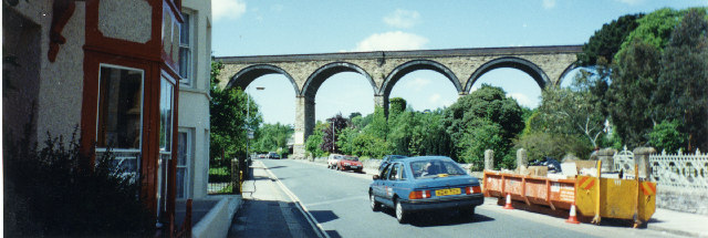
Image: © Elaine Hamby Taken: Unknown
The viaduct actually stands in the grid square to the north, but the foreground and photographer are in this square, looking northward. The right edge panoramically overlaps my photo of the facade of the former Truro Methodist Church St Georges. In-camera panorama. Photographer at SW821449.
Images are licensed for reuse under creativecommons.org/licenses/by-sa/2.0
Image Location
Latitude
50.264573
Longitude
-5.059484