The White House, west side
Introduction
The photograph on this page of The White House, west side by E Gammie as part of the Geograph project.
The Geograph project started in 2005 with the aim of publishing, organising and preserving representative images for every square kilometre of Great Britain, Ireland and the Isle of Man.

There are currently over 7.5m images from over 14,400 individuals and you can help contribute to the project by visiting https://www.geograph.org.uk
The White House, west side
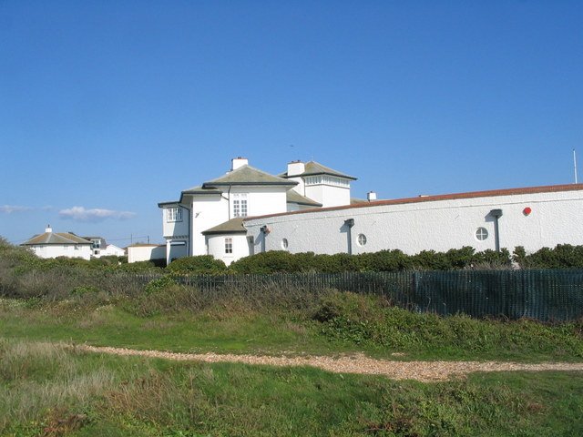
Image: © E Gammie Taken: 6 Sep 2015
Designed by Romaine Walker and built in 1903 for the Walker-Munro family who also owned Rhinefield House near Brockenhurst. After it left the family's hands in the 1930's it was used as a hospital, left derelict for a few years then renovated and converted to apartments. It is grade II listed.
Images are licensed for reuse under creativecommons.org/licenses/by-sa/2.0
Image Location
Latitude
50.721787
Longitude
-1.59366