107, High Street, Lindfield
Introduction
The photograph on this page of 107, High Street, Lindfield by Simon Carey as part of the Geograph project.
The Geograph project started in 2005 with the aim of publishing, organising and preserving representative images for every square kilometre of Great Britain, Ireland and the Isle of Man.

There are currently over 7.5m images from over 14,400 individuals and you can help contribute to the project by visiting https://www.geograph.org.uk
107, High Street, Lindfield
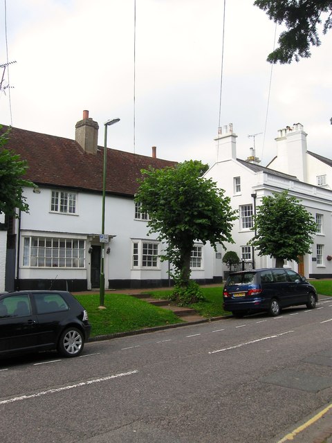
Image: © Simon Carey Taken: 30 Aug 2015
Alternatively known as Marlow House and dating from the 15th century with its timber framing concealed by a 19th century refronting which also included the addition of a shop window on the left. The building was a tea house and restaurant when listed in the early 1980s but has now reverted to being a private residence.
Images are licensed for reuse under creativecommons.org/licenses/by-sa/2.0
Image Location
Latitude
51.014713
Longitude
-0.079974