106, High Street, Lindfield
Introduction
The photograph on this page of 106, High Street, Lindfield by Simon Carey as part of the Geograph project.
The Geograph project started in 2005 with the aim of publishing, organising and preserving representative images for every square kilometre of Great Britain, Ireland and the Isle of Man.

There are currently over 7.5m images from over 14,400 individuals and you can help contribute to the project by visiting https://www.geograph.org.uk
106, High Street, Lindfield
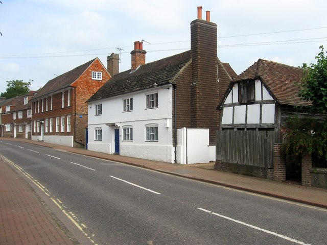
Image: © Simon Carey Taken: 30 Aug 2015
The large white building is also known as Pilstye and dates from the 17th century with an extension to the south added in the 19th. To its south is a small outbuilding that dates back to the 17th and has been used over the years as a stable, workhouse and brewery. On the left hand side are Image and Image respectively.
Images are licensed for reuse under creativecommons.org/licenses/by-sa/2.0
Image Location
Latitude
51.015326
Longitude
-0.078951