Cliff Road and The Loggerheads
Introduction
The photograph on this page of Cliff Road and The Loggerheads by John Sutton as part of the Geograph project.
The Geograph project started in 2005 with the aim of publishing, organising and preserving representative images for every square kilometre of Great Britain, Ireland and the Isle of Man.

There are currently over 7.5m images from over 14,400 individuals and you can help contribute to the project by visiting https://www.geograph.org.uk
Cliff Road and The Loggerheads
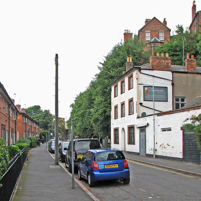
Image: © John Sutton Taken: 24 Aug 2015
The council houses of Cliff Road, over which the sandstone bluff on which the Lace Market district stands looms, were built on the site of one of the city's most notorious slums, Narrow Marsh. The Loggerheads, now closed, used to have a nine-pin skittle alley.
Images are licensed for reuse under creativecommons.org/licenses/by-sa/2.0
Image Location
Latitude
52.950334
Longitude
-1.143564