Lady Beck south of Hope Road, Leeds
Introduction
The photograph on this page of Lady Beck south of Hope Road, Leeds by Stephen Craven as part of the Geograph project.
The Geograph project started in 2005 with the aim of publishing, organising and preserving representative images for every square kilometre of Great Britain, Ireland and the Isle of Man.

There are currently over 7.5m images from over 14,400 individuals and you can help contribute to the project by visiting https://www.geograph.org.uk
Lady Beck south of Hope Road, Leeds
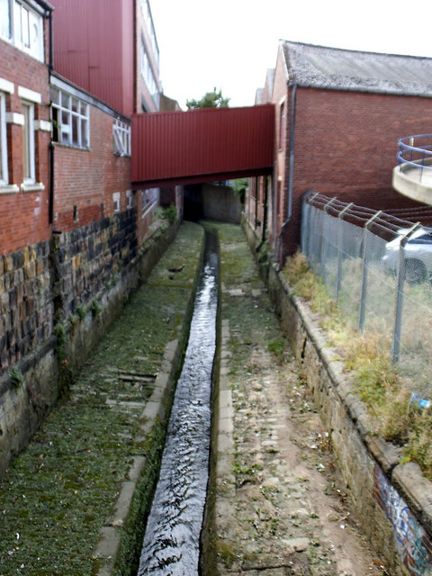
Image: © Stephen Craven Taken: 25 Aug 2015
Looking south-west from the bridge Image The stream bed has been engineered into a wider channel for storm flows, with a shallow invert channel for dry-weather flow. The Lady Beck is a continuation of Sheepscar Beck, which flows from origins on Otley Chevin, through Bramhope, Adel, Meanwood, and was the site of much early industry in Leeds. The name was derived from a Medieval Chantry Chapel, at the junction of Lady Lane and Templar Lane. Its confluence with River Aire is east of the Parish Church of St Peter [now the Minster]. (source: Leodis website).
Images are licensed for reuse under creativecommons.org/licenses/by-sa/2.0
Image Location
Latitude
53.80085
Longitude
-1.532331