Fossdyke Navigation, Saxilby
Introduction
The photograph on this page of Fossdyke Navigation, Saxilby by Dave Hitchborne as part of the Geograph project.
The Geograph project started in 2005 with the aim of publishing, organising and preserving representative images for every square kilometre of Great Britain, Ireland and the Isle of Man.

There are currently over 7.5m images from over 14,400 individuals and you can help contribute to the project by visiting https://www.geograph.org.uk
Fossdyke Navigation, Saxilby
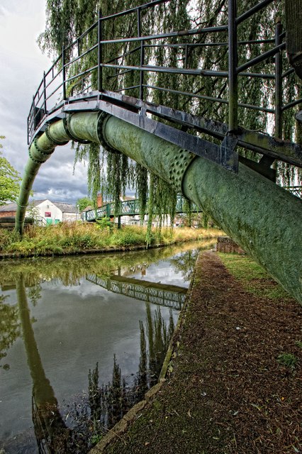
Image: © Dave Hitchborne Taken: 24 Aug 2015
The pipe arches over to Bridge Street. To the east is a footbridge, which also spans the waterway. Within this square there are two footbridges, a pipe bridge, a railway bridge and a road bridge carrying the Lincoln Road.
Images are licensed for reuse under creativecommons.org/licenses/by-sa/2.0
Image Location
Latitude
53.265711
Longitude
-0.659288