Tolworth Tower, Ewell Road, Tolworth
Introduction
The photograph on this page of Tolworth Tower, Ewell Road, Tolworth by P L Chadwick as part of the Geograph project.
The Geograph project started in 2005 with the aim of publishing, organising and preserving representative images for every square kilometre of Great Britain, Ireland and the Isle of Man.

There are currently over 7.5m images from over 14,400 individuals and you can help contribute to the project by visiting https://www.geograph.org.uk
Tolworth Tower, Ewell Road, Tolworth
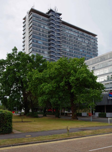
Image: © P L Chadwick Taken: 26 Jul 2015
Tolworth Tower, with its 22 storeys, dates from the early 1960's. It is used mainly as offices with shops on the ground floor. The North Wing, which is considerably lower, is now used as a Travelodge Hotel. The main block is in Ordnance Survey square TQ1965 but the part occupied by Travelodge is mainly in square TQ1966. This view was taken from Fairmead near its junction with Ewell Road. Image
Images are licensed for reuse under creativecommons.org/licenses/by-sa/2.0
Image Location
Latitude
51.380249
Longitude
-0.280699