Warmington church
Introduction
The photograph on this page of Warmington church by Graham Horn as part of the Geograph project.
The Geograph project started in 2005 with the aim of publishing, organising and preserving representative images for every square kilometre of Great Britain, Ireland and the Isle of Man.

There are currently over 7.5m images from over 14,400 individuals and you can help contribute to the project by visiting https://www.geograph.org.uk
Warmington church
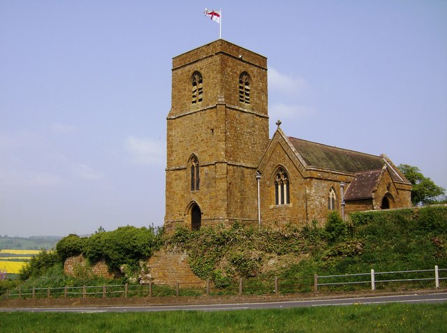
Image: © Graham Horn Taken: 27 Apr 2007
The church is right on the grid square line; the 1:25K map suggests this square, the 1:50K map suggests the next square east. The road is in this square, a short section of dual carriageway separated by a wide central reservation on which the photographer is standing. It is also near the summit of a steep hill climbing up from the valley to the left. The church, made from the local Hornton stone, stands prominently on the hilltop overlooking the village behind.
Images are licensed for reuse under creativecommons.org/licenses/by-sa/2.0
Image Location


Leaflet Map data © OpenStreetMap
Latitude
52.124209
Longitude
-1.40269