Criplands, Graveleye Lane, Lindfield
Introduction
The photograph on this page of Criplands, Graveleye Lane, Lindfield by Simon Carey as part of the Geograph project.
The Geograph project started in 2005 with the aim of publishing, organising and preserving representative images for every square kilometre of Great Britain, Ireland and the Isle of Man.

There are currently over 7.5m images from over 14,400 individuals and you can help contribute to the project by visiting https://www.geograph.org.uk
Criplands, Graveleye Lane, Lindfield
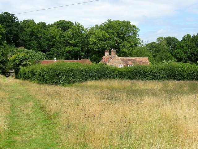
Image: © Simon Carey Taken: 4 Aug 2015
The house dates from the 17th century and was once the parish pest house used to house those with infectious diseases away from the main area of settlement. Was called Pest House on Lindfield's 1845 tithe map, Pesthouse Farm on the 1875 OS map, Cripland Court Farm on the 1910 edition and just Criplands from the 1960s onwards. Its former isolation is about to end with a new development on fields to the east, see Image
Images are licensed for reuse under creativecommons.org/licenses/by-sa/2.0
Image Location
Latitude
51.003061
Longitude
-0.076892