Newburgh Parish Church
Introduction
The photograph on this page of Newburgh Parish Church by Rude Health as part of the Geograph project.
The Geograph project started in 2005 with the aim of publishing, organising and preserving representative images for every square kilometre of Great Britain, Ireland and the Isle of Man.

There are currently over 7.5m images from over 14,400 individuals and you can help contribute to the project by visiting https://www.geograph.org.uk
Newburgh Parish Church
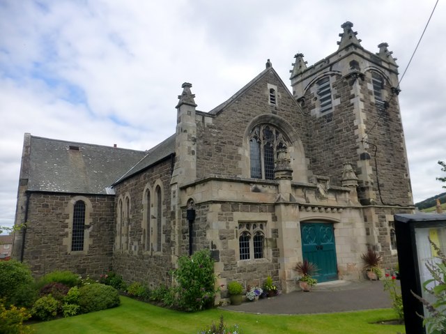
Image: © Rude Health Taken: 30 Jul 2015
Newburgh Parish Church was built between 1905 and 1906, facing south onto the road towards the east of Newburgh High Street, opposite the school and within walking distance of the town cemetery.
Images are licensed for reuse under creativecommons.org/licenses/by-sa/2.0
Image Location
Latitude
56.351092
Longitude
-3.231409