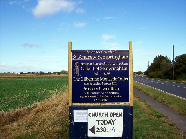
The road to Sempringham, near Bourne, Lincolnshire
Introduction
The photograph on this page of The road to Sempringham, near Bourne, Lincolnshire by Rex Needle as part of the Geograph project.
The Geograph project started in 2005 with the aim of publishing, organising and preserving representative images for every square kilometre of Great Britain, Ireland and the Isle of Man.
There are currently over 7.5m images from over 14,400 individuals and you can help contribute to the project by visiting https://www.geograph.org.uk

Image: © Rex Needle Taken: 11 Oct 2009
The best route to Sempringham church is along the A15 and then fork off on the B1177 north of Bourne, taking the second left turn at Pointon village and then look out for this blue sign alongside a farm track on the left hand side. You will then face almost a mile of uneven cart track but a glimpse of the pinnacled tower of the Norman church is always with you behind trees on the horizon, a lonely landmark on a hillock among cultivated fields, and soon the winding road will bring you to its door. See also Image

