Aerial View of Wytham Village, Oxfordshire
Introduction
The photograph on this page of Aerial View of Wytham Village, Oxfordshire by Dave Price as part of the Geograph project.
The Geograph project started in 2005 with the aim of publishing, organising and preserving representative images for every square kilometre of Great Britain, Ireland and the Isle of Man.

There are currently over 7.5m images from over 14,400 individuals and you can help contribute to the project by visiting https://www.geograph.org.uk
Aerial View of Wytham Village, Oxfordshire
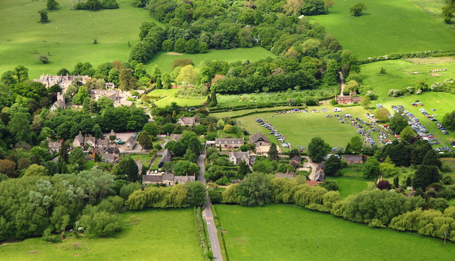
Image: © Dave Price Taken: 2 Jun 2013
Taken from paramotor above Godstow Road. The greater part of the village fills the left of the photo, inc. Wytham Abbey, All Saints Church and the White Hart Public House. Wytham Cricket Club's (http://www.wythamcricket.org/ ) pitch is to the right where one of the regular Car Boot sales is taking place. The village's website is http://www.wytham-village.org.uk/ . Image
Images are licensed for reuse under creativecommons.org/licenses/by-sa/2.0
Image Location
Latitude
51.773617
Longitude
-1.313555