Ynys Bridge south of Taffs Well
Introduction
The photograph on this page of Ynys Bridge south of Taffs Well by Jaggery as part of the Geograph project.
The Geograph project started in 2005 with the aim of publishing, organising and preserving representative images for every square kilometre of Great Britain, Ireland and the Isle of Man.

There are currently over 7.5m images from over 14,400 individuals and you can help contribute to the project by visiting https://www.geograph.org.uk
Ynys Bridge south of Taffs Well
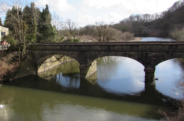
Image: © Jaggery Taken: 3 Mar 2015
Viewed from the newer bridge http://www.geograph.org.uk/photo/4597659 50 metres upstream. The bridge carries Heol-yr-Ynys across the River Taff, roughly midway between Tongwynlais and Taffs Well. Formerly a major river crossing, the bridge now has little traffic since the opening of the bridge upstream. Ynys Bridge was Grade II listed in 2000.
Images are licensed for reuse under creativecommons.org/licenses/by-sa/2.0
Image Location
Latitude
51.535254
Longitude
-3.260477