National Grid cooling station, John Williams Close
Introduction
The photograph on this page of National Grid cooling station, John Williams Close by Stephen Craven as part of the Geograph project.
The Geograph project started in 2005 with the aim of publishing, organising and preserving representative images for every square kilometre of Great Britain, Ireland and the Isle of Man.

There are currently over 7.5m images from over 14,400 individuals and you can help contribute to the project by visiting https://www.geograph.org.uk
National Grid cooling station, John Williams Close
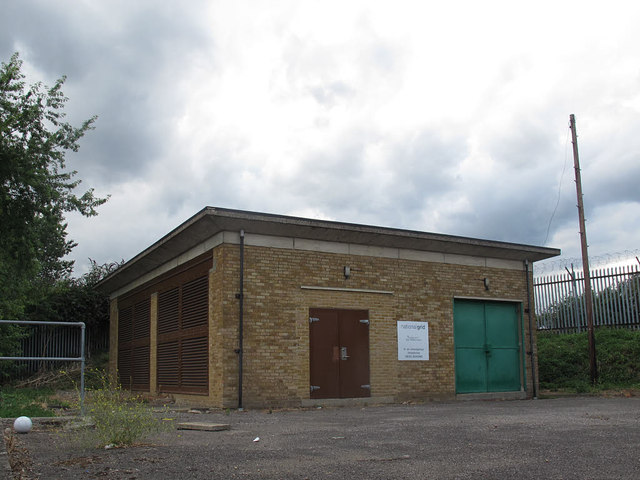
Image: © Stephen Craven Taken: 22 Jul 2015
One of 14 surface cooling station buildings at 1-mile intervals serving the National Grid underground cable tunnel between Bexley Image and Wimbledon. To allow these cables to carry more current, there are cooling pipes adjacent to the cables, carrying water pumped from these cooling stations. The shafts, tunnels and cooling stations were originally constructed in the 1960’s and are the route for the main 275kV cables supplying South London. They were refurbished in 2005. [Sources: http://www.skanska.co.uk/cdn-1cd94af82cd9070/Global/Sevices/Civils/Document/Wimbledon-Tunnels-Project-Sheet.pdf and http://www.alpine-components.co.uk/case-studies-feedback/national-grid/john-howlett/ ] The facility is roughly on the line of a railway shown on old maps that linked sidings at Deptford Wharf on the Thames to the South London Loop line through Peckham.
Images are licensed for reuse under creativecommons.org/licenses/by-sa/2.0
Image Location
Latitude
51.480686
Longitude
-0.050242