Barn in valley of Argill Beck
Introduction
The photograph on this page of Barn in valley of Argill Beck by Trevor Littlewood as part of the Geograph project.
The Geograph project started in 2005 with the aim of publishing, organising and preserving representative images for every square kilometre of Great Britain, Ireland and the Isle of Man.

There are currently over 7.5m images from over 14,400 individuals and you can help contribute to the project by visiting https://www.geograph.org.uk
Barn in valley of Argill Beck
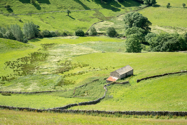
Image: © Trevor Littlewood Taken: 30 Jul 2015
The location is on the Cumbrian side of the Pennines just below the A66. The course of Argill Beck is traced by the continuous line of trees. The area left of the building is a damp one where the creamy colour is due to the flowering of meadowsweet -Filipendula ulmaria
Images are licensed for reuse under creativecommons.org/licenses/by-sa/2.0
Image Location
Latitude
54.515878
Longitude
-2.220856