High Wycombe: Early industrial units on Lancaster Road
Introduction
The photograph on this page of High Wycombe: Early industrial units on Lancaster Road by Nigel Cox as part of the Geograph project.
The Geograph project started in 2005 with the aim of publishing, organising and preserving representative images for every square kilometre of Great Britain, Ireland and the Isle of Man.

There are currently over 7.5m images from over 14,400 individuals and you can help contribute to the project by visiting https://www.geograph.org.uk
High Wycombe: Early industrial units on Lancaster Road
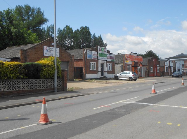
Image: © Nigel Cox Taken: 25 Jul 2015
These six small industrial units were probably the earliest buildings on the Cressex Industrial Estate, now the Cressex Business Park. The 1938 Edition of the large scale Ordnance Survey map does not show them but the 1960 version certainly does, dating them probably to the 1950s. The cones in the centre of the road were demarcating temporary one-way traffic workings while an underground service was being laid, as evidenced by the new trench scar in the foreground, when the photograph was taken.
Images are licensed for reuse under creativecommons.org/licenses/by-sa/2.0
Image Location
Latitude
51.619017
Longitude
-0.769029