Dukinfield Bridge
Introduction
The photograph on this page of Dukinfield Bridge by Keith Williamson as part of the Geograph project.
The Geograph project started in 2005 with the aim of publishing, organising and preserving representative images for every square kilometre of Great Britain, Ireland and the Isle of Man.

There are currently over 7.5m images from over 14,400 individuals and you can help contribute to the project by visiting https://www.geograph.org.uk
Dukinfield Bridge
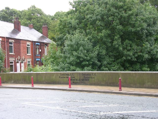
Image: © Keith Williamson Taken: 29 Aug 2005
This bridge carries Whitelands over the River Tame. The boundary between Ashton-under-Lyne and Dukinfield, and the boundary between Lancashire and Cheshire prior to local government reorganisation in 1974. Taken from SJ94149866.
Images are licensed for reuse under creativecommons.org/licenses/by-sa/2.0
Image Location


Leaflet Map data © OpenStreetMap
Latitude
53.484623
Longitude
-2.089777