Inverted benchmark on wall outside #128 Bingley Road
Introduction
The photograph on this page of Inverted benchmark on wall outside #128 Bingley Road by Roger Templeman as part of the Geograph project.
The Geograph project started in 2005 with the aim of publishing, organising and preserving representative images for every square kilometre of Great Britain, Ireland and the Isle of Man.

There are currently over 7.5m images from over 14,400 individuals and you can help contribute to the project by visiting https://www.geograph.org.uk
Inverted benchmark on wall outside #128 Bingley Road
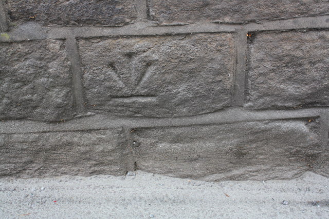
Image: © Roger Templeman Taken: 16 Jun 2015
That the benchmark (described on the Bench Mark Database at http://www.bench-marks.org.uk/bm68722 ) is inverted suggests the wall may have been rebuilt after the mark was levelled in 1956
Images are licensed for reuse under creativecommons.org/licenses/by-sa/2.0
Image Location
Latitude
53.83548
Longitude
-1.8006