Colquhoun Park Flood Alleviation Scheme
Introduction
The photograph on this page of Colquhoun Park Flood Alleviation Scheme by Richard Sutcliffe as part of the Geograph project.
The Geograph project started in 2005 with the aim of publishing, organising and preserving representative images for every square kilometre of Great Britain, Ireland and the Isle of Man.

There are currently over 7.5m images from over 14,400 individuals and you can help contribute to the project by visiting https://www.geograph.org.uk
Colquhoun Park Flood Alleviation Scheme
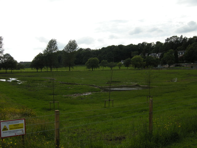
Image: © Richard Sutcliffe Taken: 10 Jul 2015
In recent years there have been several incidents of flooding around Conan Avenue in Bearsden. The area at the north east end of Colquhoun Park (between Conan Avenue and Station Road) has recently been developed into a wetland area to absorb flood water, and at the same time creating a good wildlife habitat. The area is currently fenced off to allow the vegetation to become established.
Images are licensed for reuse under creativecommons.org/licenses/by-sa/2.0
Image Location
Latitude
55.915209
Longitude
-4.340787