Brunswick Square
Introduction
The photograph on this page of Brunswick Square by Simon Carey as part of the Geograph project.
The Geograph project started in 2005 with the aim of publishing, organising and preserving representative images for every square kilometre of Great Britain, Ireland and the Isle of Man.

There are currently over 7.5m images from over 14,400 individuals and you can help contribute to the project by visiting https://www.geograph.org.uk
Brunswick Square
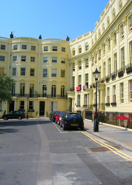
Image: © Simon Carey Taken: 3 Jun 2007
The north western side as viewed from the junction with Brunswick Place. The square was built as a high class estate between 1824-28 by Wilds and Busby and originally administered as a separate entity until 1875 when it became part of Hove. The houses themselves eventually became subdivided into flats and bedsits and by 1945 had become so squalid and lacking in amenities that Hove council considered demolishing the entire estate. However, the outcry ensured a grade II listing was applied and the houses have returned to their original condition including the outside colour.
Images are licensed for reuse under creativecommons.org/licenses/by-sa/2.0
Image Location
Latitude
50.825152
Longitude
-0.159324