
Foxgloves on the side of Bigbury Camp
Introduction
The photograph on this page of Foxgloves on the side of Bigbury Camp by Marathon as part of the Geograph project.
The Geograph project started in 2005 with the aim of publishing, organising and preserving representative images for every square kilometre of Great Britain, Ireland and the Isle of Man.

There are currently over 7.5m images from over 14,400 individuals and you can help contribute to the project by visiting https://www.geograph.org.uk
Foxgloves on the side of Bigbury Camp
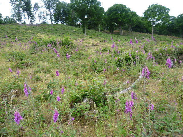
Image: © Marathon Taken: 28 Jun 2015
Bigbury Camp is the major prehistoric earthwork in the Canterbury area, and up until recently had been masked by the woodland of South Blean, part of one of the largest areas of ancient woodland in Kent. This hill fort was first recognised in 1874, following discoveries of Iron Age tools. Archaeological excavations since have revealed the extent of the site and shown it to have been occupied from at least the later part of the 1st Century BC. The hill fort is believed to have been the site of Julius Caesar's first battle in 54 BC as he led his forces in the Roman invasion of Britain. The illustrated view on the adjacent information board - see http://www.geograph.org.uk/photo/4547891 - depicts the hill fort in its prime. The large building on the skyline is a gate presumed to have given access from the lower working area to the defended hilltop. Kent Wildlife Trust has worked with English Heritage to restore this Iron Age hill fort to the historical landscape of two thousand years ago. The North Downs Way passes along the northern edge of the hill fort.
Images are licensed for reuse under creativecommons.org/licenses/by-sa/2.0
Image Location

Latitude
51.278581
Longitude
1.033018