Tomb Street, Belfast (June 2015)
Introduction
The photograph on this page of Tomb Street, Belfast (June 2015) by Albert Bridge as part of the Geograph project.
The Geograph project started in 2005 with the aim of publishing, organising and preserving representative images for every square kilometre of Great Britain, Ireland and the Isle of Man.

There are currently over 7.5m images from over 14,400 individuals and you can help contribute to the project by visiting https://www.geograph.org.uk
Tomb Street, Belfast (June 2015)
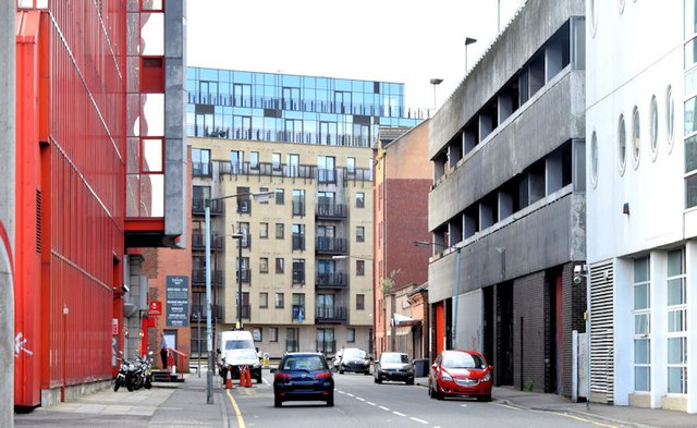
Image: © Albert Bridge Taken: 30 Jun 2015
See Image (February 2010). A similar view more than five years later. The rather bleak western side (right) would see quite a change, notably with the removal of the grey multi-storey car park (second right), if the development mentioned in the shared description (below) proceeds. Perhaps it’s just my impression but the street has always had a slightly claustrophobic, overly-enclosed feeling.
Images are licensed for reuse under creativecommons.org/licenses/by-sa/2.0
Image Location
Latitude
54.602692
Longitude
-5.92361