Monk's Ferry slipway, Birkenhead
Introduction
The photograph on this page of Monk's Ferry slipway, Birkenhead by El Pollock as part of the Geograph project.
The Geograph project started in 2005 with the aim of publishing, organising and preserving representative images for every square kilometre of Great Britain, Ireland and the Isle of Man.

There are currently over 7.5m images from over 14,400 individuals and you can help contribute to the project by visiting https://www.geograph.org.uk
Monk's Ferry slipway, Birkenhead
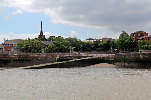
Image: © El Pollock Taken: 28 Jun 2015
Seen from the ferry after departing from Woodside. Monk's Ferry is the location of the original ferry from Birkenhead. The church spire is of St. Mary's Tower, on the grounds of Birkenhead Priory.
Images are licensed for reuse under creativecommons.org/licenses/by-sa/2.0
Image Location


Leaflet Map data © OpenStreetMap
Latitude
53.391329
Longitude
-3.007434