The end of the Flitch Way at Start Hill
Introduction
The photograph on this page of The end of the Flitch Way at Start Hill by Marathon as part of the Geograph project.
The Geograph project started in 2005 with the aim of publishing, organising and preserving representative images for every square kilometre of Great Britain, Ireland and the Isle of Man.

There are currently over 7.5m images from over 14,400 individuals and you can help contribute to the project by visiting https://www.geograph.org.uk
The end of the Flitch Way at Start Hill
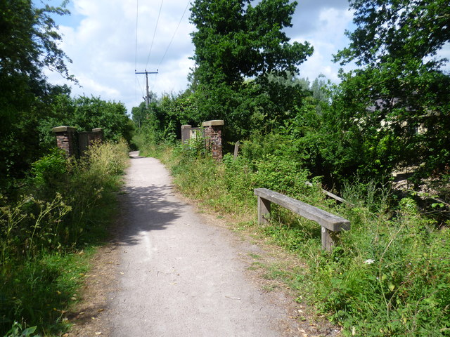
Image: © Marathon Taken: 27 Jun 2015
The Flitch Way begins and ends here at its western end, where cars can be parked in a small lay-by. The Flitch Way is 15 miles long and follows the former Bishop's Stortford to Braintree railway. Its name comes from a medieval ceremony, which originated in Little Dunmow and which still takes place every four years. The ceremony involved married couples trying to prove that they hadn't argued for a year and a day, and if successful they were awarded with a Flitch (or side) of bacon. For a leaflet about The Flitch Way see http://www.essexhighways.org/Uploads/Files/flitchway.pdf The railway was opened on 22nd February 1869 and was closed to passengers on 3rd May 1952. It was closed completely on 18th April 1966. For a much fuller history of the railway see http://www.disused-stations.org.uk/t/takeley/ Takeley station was the first station reached along the line to the east. The bridge just ahead can be seen from below at http://www.geograph.org.uk/photo/4544177
Images are licensed for reuse under creativecommons.org/licenses/by-sa/2.0
Image Location


Leaflet Map data © OpenStreetMap
Latitude
51.86914
Longitude
0.205322