Haig Colliery - Whitehaven
Introduction
The photograph on this page of Haig Colliery - Whitehaven by Ashley Dace as part of the Geograph project.
The Geograph project started in 2005 with the aim of publishing, organising and preserving representative images for every square kilometre of Great Britain, Ireland and the Isle of Man.

There are currently over 7.5m images from over 14,400 individuals and you can help contribute to the project by visiting https://www.geograph.org.uk
Haig Colliery - Whitehaven
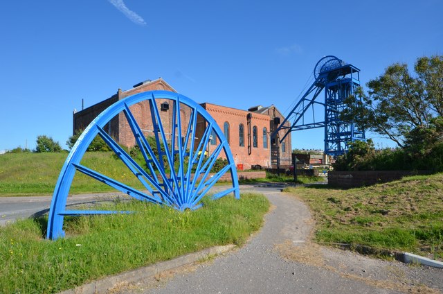
Image: © Ashley Dace Taken: 23 Jun 2015
The former colliery is now a museum focused on the story of the West Cumbrian coalfield. The colliery ran until the 1980s under full steam power (see other photos on geograph). The mine exploited deposits under the sea which are currently being re-explored by modern exploration methods. It is hoped to open a drift mine towards the end of the decade and mine the vast undersea resources of coking coal in demand by European steelworks.
Images are licensed for reuse under creativecommons.org/licenses/by-sa/2.0
Image Location
Latitude
54.542906
Longitude
-3.598134