The Longwood Hall, Stanningley
Introduction
The photograph on this page of The Longwood Hall, Stanningley by Stephen Craven as part of the Geograph project.
The Geograph project started in 2005 with the aim of publishing, organising and preserving representative images for every square kilometre of Great Britain, Ireland and the Isle of Man.

There are currently over 7.5m images from over 14,400 individuals and you can help contribute to the project by visiting https://www.geograph.org.uk
The Longwood Hall, Stanningley
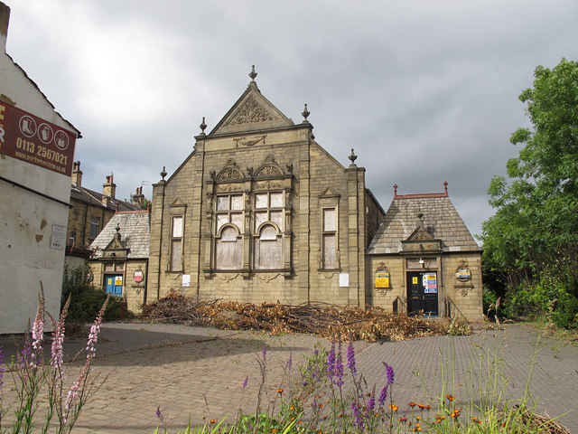
Image: © Stephen Craven Taken: 18 Jun 2015
This building, which is shown on earlier maps as a Congregational chapel, looked derelict from this southern side, but is advertised online as a small business centre and its main entrance appears to be the other end.
Images are licensed for reuse under creativecommons.org/licenses/by-sa/2.0
Image Location
Latitude
53.805265
Longitude
-1.670916