The Parkland Walk near Muswell Hill Road
Introduction
The photograph on this page of The Parkland Walk near Muswell Hill Road by Marathon as part of the Geograph project.
The Geograph project started in 2005 with the aim of publishing, organising and preserving representative images for every square kilometre of Great Britain, Ireland and the Isle of Man.

There are currently over 7.5m images from over 14,400 individuals and you can help contribute to the project by visiting https://www.geograph.org.uk
The Parkland Walk near Muswell Hill Road
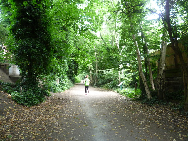
Image: © Marathon Taken: 17 Jun 2015
The Parkland Walk follows part of the Edgware, Highgate & London Railway. The line from Finsbury Park to Highgate and on to Edgware opened in 1867, and a branch from Finchley to High Barnet opened in 1872. The branch from Highgate to Alexandra Palace (which followed the route here) opened in 1873. In the 1930s it was proposed to transfer all the lines to become part of London Transport's Northern line. The section from Highgate to High Barnet and Mill Hill were transferred in 1940. Although partly completed, the rest of the scheme was halted and then abandoned after the Second World War. Infrequent passenger trains continued to Alexandra Palace but these ceased in 1954. Some freight trains ran until 1964 and the last use was by London Transport for the transfer of some Tube trains until 1970. Cranley Gardens station was just behind where I am standing, on the other side of Muswell Hill Road. See http://www.disused-stations.org.uk/c/cranley_gardens/ for more information about Cranley Gardens station and the line to Alexandra Palace. Schemes to use the land were developed by the neighbouring Boroughs, and all included a Walk. The Parkland Walk has now become London's longest nature reserve. It was officially opened in 1984.
Images are licensed for reuse under creativecommons.org/licenses/by-sa/2.0
Image Location
Latitude
51.586645
Longitude
-0.146179